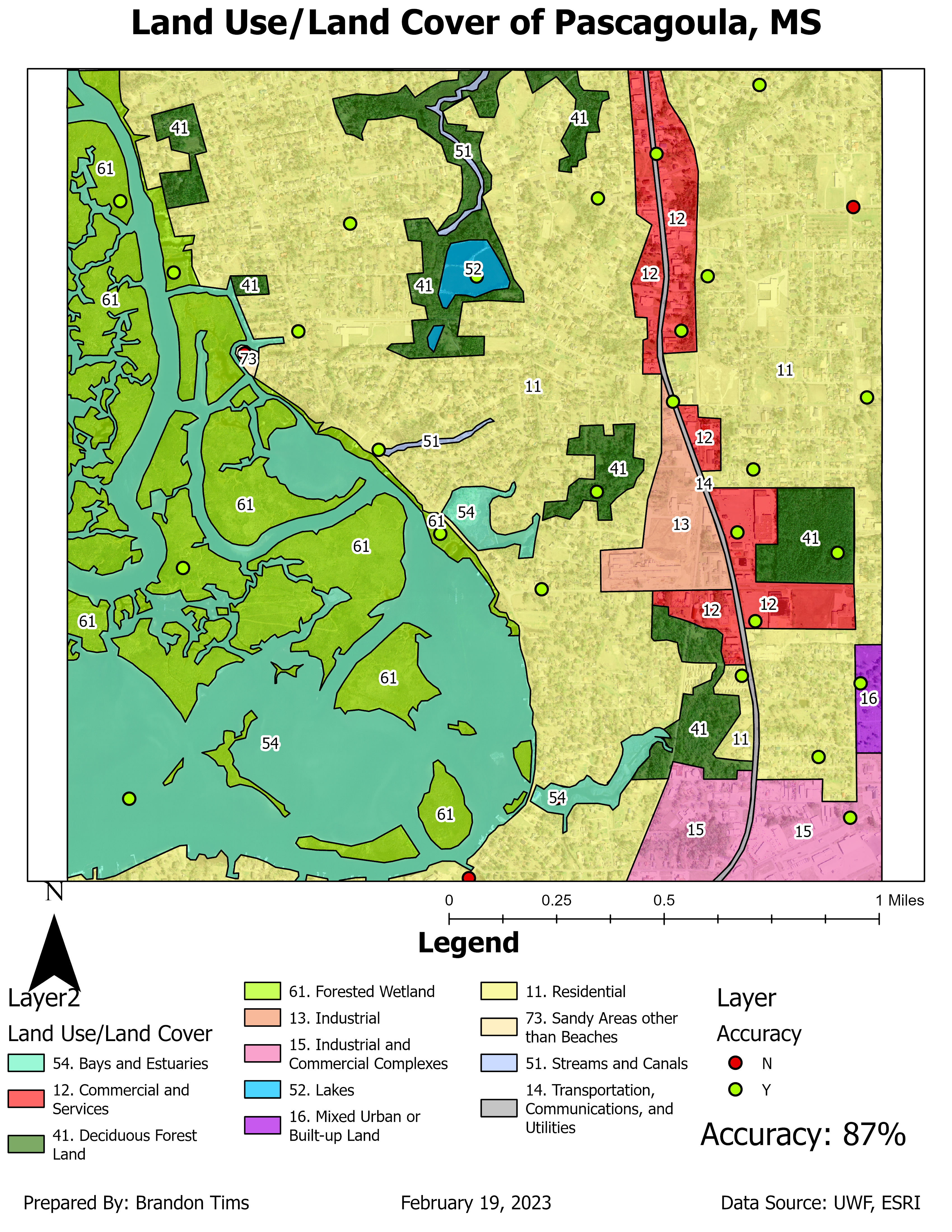
This map is classified in two categories tone and texture. For tone they are classified by: very light, light, medium, dark, very dark. For texture they are classified by: very fine, fine, mottled, coarse, and very coarse.

For this map I identified features and objects by: shape size, shadows, pattern, and association. For shape size I
identified three features: the parked cars, the main road and the restaurant.
The main roads shape was easily identifiable and so were the tiny parked cars
in the parking lot. The restaurants shape was also easy to identify as it was
the largest building along the beach. For shadows I identified objects by their
shadow such as the water tower, the sign to a store and a light pole along the
road. For pattern I looked for objects that had a similar pattern to them such
as: the ocean (because of wave action), the parking lot, and the beach housing
community to the east in the image. Finally I identified objects by association
and found: the pier, the hotel pool (in middle of hotel), and the community
pool for the housing on the east side of image.