Sunday, February 19, 2023
Land Use/Land Cover of Pascagoula, MS
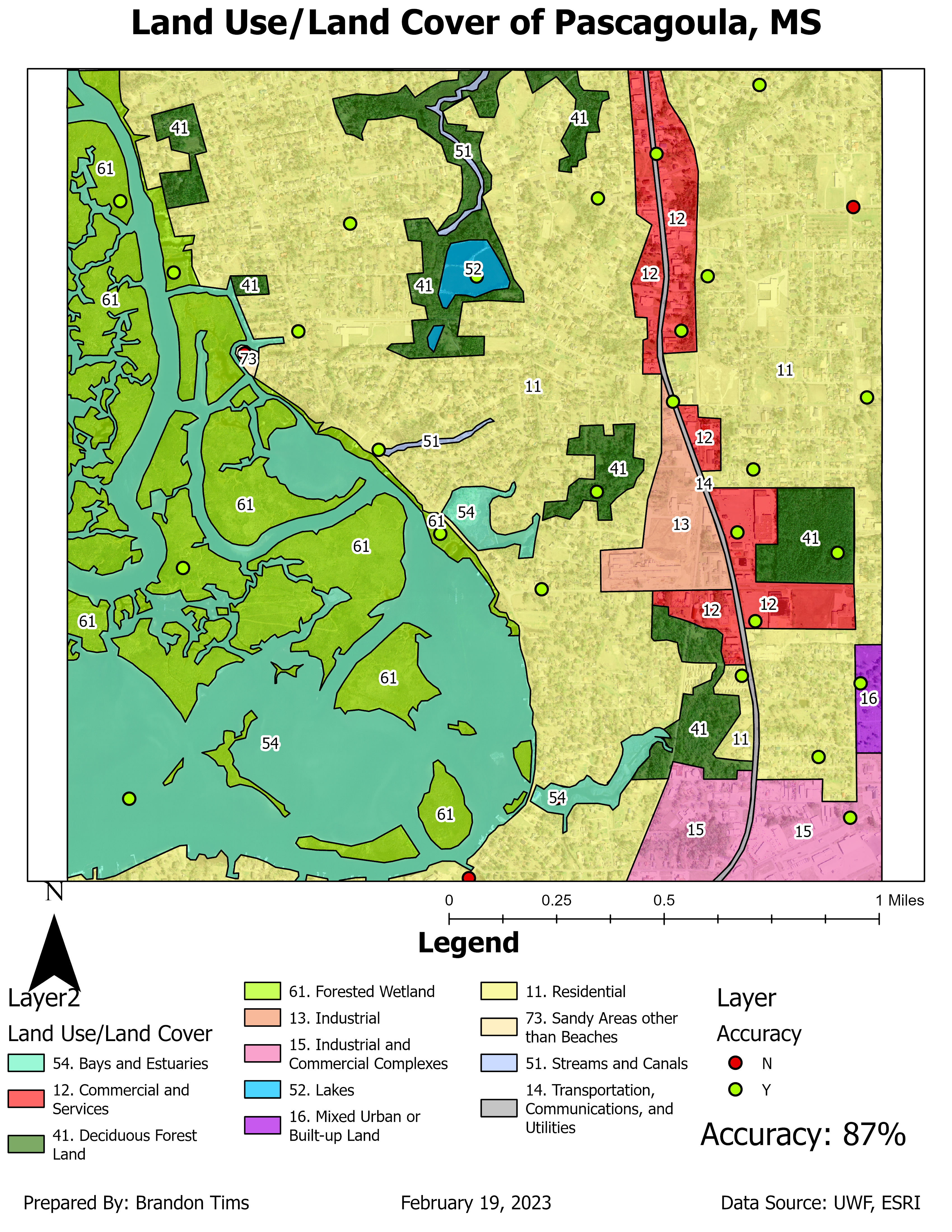
This map displays the land use/land cover of the Pascagoula, MS area. It also displays the level of accuracy that each land use/land cover zone has by using point features to show if these areas are zoned correctly in the correct areas. The map I produced has a 87% point accuracy which is relatively pretty good accuracy.
Subscribe to:
Post Comments (Atom)
Module 7 Google Earth
Google Earth For this week's lab we were tasked with creating a dot density map of south Florida in Google Earth. The map also includes...
-
GIS Day Family Presentation For my GIS day I conducted my own event at my house with my family and girlfriend. The event took place in my li...
-
Map Critique Module: 1 This week's class was an introduction to Cartography and Map design principles. We covered some basic cartography...

No comments:
Post a Comment