Module 2: Typography

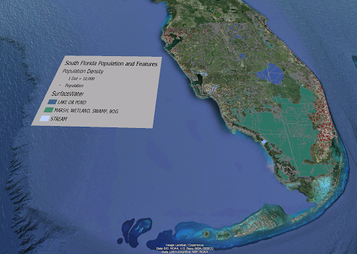
This is a map that I created to show the major swamps and river systems in Florida. This map also displays the major cities and capitol of Florida. The goals of this assignment were to define and insert essential map element's, label a map in accordance with general typographic guidelines, and employ proper type placement for different feature types (point, line, area).
One of the customizations I did
for my map was using themed point symbols for the capital and major cities. I
customized labels by using a white outline for major cities, capital, and
swamps. I also edited the vertices with the river names to make the fit better
and more centered on the rivers. I used a green fill color for swamps, I didn’t
change color of rivers I liked the baby blue color they already use, and made
all counties a deep blue so rivers were more identifiable.


No comments:
Post a Comment