For this weeks lab I explored the ERDAS Imagine 32-bit software. I identified how to utilize a subset of the data in the software and export that subset of data to ArcGIS Pro and also identified multiple ways to save, export, and zoom into the different views. The map I created above is the subset of an original image I had explored in ERDAS Imagine 32-bit and after exporting the subset data file into ArcGIS pro, I created a map of the subset area with the land information categorized by the "Class_Names" in the legend and additionally, the area in hectares corresponding to those different land classifications to the right of them in the legend.
Subscribe to:
Post Comments (Atom)
Module 7 Google Earth
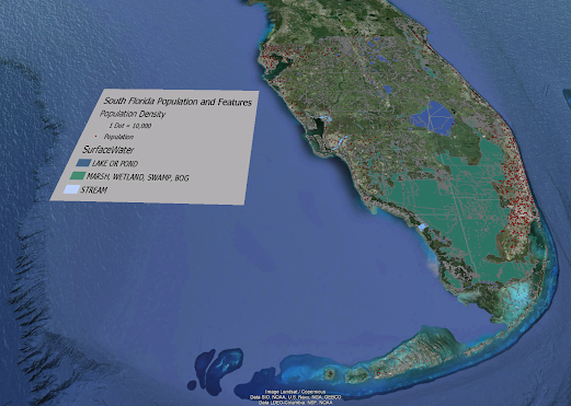
Google Earth For this week's lab we were tasked with creating a dot density map of south Florida in Google Earth. The map also includes...

-
GIS Day Family Presentation For my GIS day I conducted my own event at my house with my family and girlfriend. The event took place in my li...
-
The output for 3 radians to degrees is 171.9745222929936 degrees. My interpretation of Zen python by Tim Peters: These are the principles o...


No comments:
Post a Comment